
Birmingham Council Boundaries from 1838 to 1931
Birmingham Council Boundary Changes 1838 to 1931
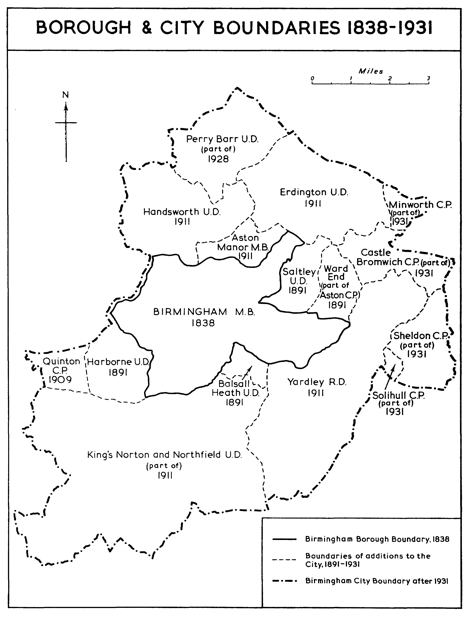
Sometimes you spot some things that are surprisingly mundane and interesting. This map charting the growth of Birmingham’s local authority to 1938 fits into that category and comes from the website www.british-history.ac.uk and the 1964 book A History of the County of Warwick: Volume 7 edited by WB Stephens.
Perhaps it’s the simple fascination of tracing history through maps?

Thought I’d cheer everyone up by pointing out that the book referred to, Vol 7 of A History of the County of Warwick, tells us how important is production of cars at Longbridge and chocolate at Bournville …
Locally, in Acocks Green, the transfer of Yardley from Worcestershire to Birmingham, in 1911, is a well known story. Acocks Green police station, an attractive red terracotta building, complete with local court, was built 1909, was provided by Worcestershire for the parish of Yardley, of which Acocks Green was a part. You can still see the fruit, pears I think (?) over the door which, I understand, are an emblem of Worcestershire. There is speculation that this nice building was partly a present to the area to encourage it stay with Worcestershire.