
Birmingham: A History in Maps by Paul Leslie Line
- Westley’s 1731 plan of Birmingham. Photo courtesy of mapseeker.co.uk
A friend and I were visiting Berrington Hall in Herefordshire a while ago and saw a framed old map of Birmingham from the mid 1700’s hanging on the wall of the study. We studied it for quite some time and both found it completely absorbing. I remember thinking ‘I’d like to see similar maps, but I really don’t want to have to trawl the internet to find them.’ With Birmingham: A History in Maps , Paul Leslie Line has done the work for me.
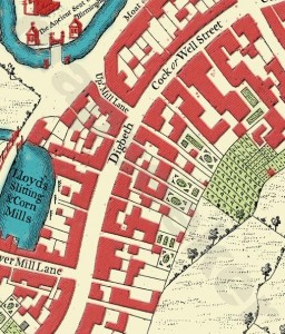
From the early 1600’s to the present day and beyond, this hardback book encompasses various town plans and maps, some of which are so beautiful they’re works of art in their own right. Informative text and photographs of the city accompany the maps but Line rightly lets the maps take centre stage. One of the best things about the book is that the maps are reproduced in their entirety but also in enlarged sections which makes map reading much less of a strain on the eyes. It’s fascinating to see the town grow and the effect that urbanisation has had on the landscape over the centuries.
Definitely one for anyone interested in a visual history of Birmingham’s development. Find it here on Amazon.

Birmingham Council Boundaries from 1838 to 1931 | Birmingham Conservation Trust April 2, 2010
[…] Perhaps it’s the simple fascination of tracing history through maps? […]